Shenandoah National Park was established in 1935 and in 1936 President Roosevelt dedicated the park to "the recreation and re-creation".
Shenandoah has over 500 miles of hiking trails; most of which can be accessed by Skyline Drive. The 105 mile long Skyline Drive, which turned 75 years old in 2006 was at first being constructed by local farmers that needed the work during the depression. Also, there was a need for parks in the east to compete with those in the west. Soon the 105 miles was completed. Full of vistas and hiking trails people travel from all over the world to Shenandoah and Skyline Drive.
After the weekend of caving festivities at Laurel Caverns I cruised down to Skyline Drive. But not before stopping at a couple Forts along the way. I explored Fort Necessity and Fort Mills Ridge. Quite interesting.
I spent 2 days in Shenandoah, but could have spent a week. Sunday night I stayed at a hotel, in Front Royal, 1/4 mile away from the north entrance to the park and Skyline Drive. First thing Monday morning I was off and headed to the visitors center where I picked up a few hiking trails books, viewed the short park video, checked out the exhibits and shoved off.
The trail guides proved to be indispensable...especially the $2/each booklets entitled, "Hikes to Waterfalls" and "Hikes to Peaks and Vistas". I also picked up A Falcon Guide Hiking Shenandoah National Park, which has some good directions and maps, but I found myself returning to the $2 booklets.
A 29 pg booklet, A Hiker's Guide..Geology: Old Rag Mountain, spoke to me and I had to pick up. The Old Rag hike is also in the Falcon Guide book. It seems like every park needs to have a mountain or two that somehow distinguishes itself from the others. Old Rag Mountain seems to be one of them. Just the name itself makes you wonder. Old Rag is one of the parks most famous peaks. Parts of the 2200 feet trail uphill to the summit entail scrambling over rocks and "for a mile or more, you must shinny over boulders using, in places, three point stands." There is even an area where you need to practically crawl through a short "cave", which is a large crack in the Old Rag Granie. You'll find natural steps, blue quartz, black mica, great views, etc. If you want to do the hike in a loop it's about 7 miles. I would definately like to do this interesting and challenging hike next time I find myself in Shenandoah National Park.
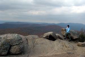
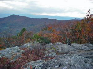
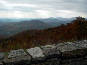
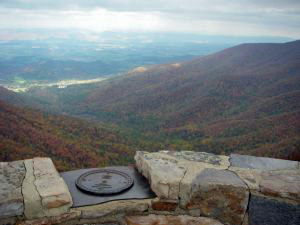
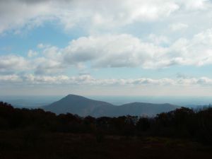
Monday and most of Tuesday I hiked the trails and stopped at 99% of the, probably, dozens of overlooks along the 2 lane drive. It was awesome. The fall foliage was at it's peak. I hiked to the summit of a few mountains, checked out a couple waterfalls, you know, the usual.
The hikes I did are as follows:
Marys Rock,
Pass Mountain,
Hawksbill Mountain,
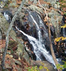
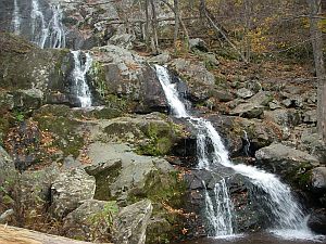
Rose River Falls, and
Dark Hollow Falls
On Wednesday, my day to drive home, I stopped off at Seneca Rocks in WV. I hiked the Seneca Rocks Trail to the observation tower and then scrambled over the rocks past the "Stop!! 15 people have died at Seneca Rocks! This is very dangerous!" sign to the narrow summit. You could see nearly 360 degrees. It was fantastic. To make it even better the wind wasn't even that bad. Consequently I hung out up there for about 1/2 hour just soaking the views in and taking pictures.